Golden Eagles are rarely seen in El Paso’s Franklin Mountains. They are dependent on lowland habitat surrounding the mountain peaks where they hunt for prey species including jackrabbits and desert cottontails.
By Rick LoBello, Board Member
Enjoy reading about our amazing Chihuahuan Desert. Sign up for a free subscription to our blog.
How we develop or not develop land in El Paso and the surrounding area is a big issue on the minds of many people. We need land for new homes, businesses, roads and recreation and as each year passes and more land is developed, the amount of available undeveloped land decreases.
Natural landscapes on undeveloped lands provide free ecological services like purifying the air we breathe and the water we drink, protecting habitat and wildlife, biodiversity, protecting and regenerating our soil nutrients, and pollinating our crops and natural vegetation. These services are lost, sometimes completely, through land degradation.
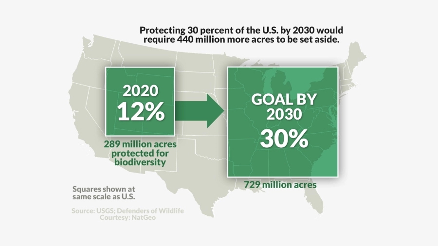
Urban sprawl is the main cause of the degradation of our natural environment here in El Paso and across the nation. To help protect natural landscapes for future generations President Biden’s administration has a 30×30 land conservation plan promoting a voluntary nationwide effort to conserve, connect and restore 30% of the nation’s lands and waters by the year 2030. Can El Paso support this national effort and help our nation reach the 30 x 30 conservation goal by 2030?

Currently the size of the City of El Paso is 165,952 acres. When you add up protected areas at Franklin Mountains State Park – 26,627 acres, Castner Range -7,081 acres (working towards a designation as a national monument, currently owned by Department of Defense), Knapp Land Nature Preserve– 353 acres, Lost Dog Trail – 1,001 acres, Resler Canyon Nature Preserve– 91 acres and Thunder Canyon – 26 acres (Source Frontera Land Alliance), the total area of conserved lands is 35,179 acres or 21% of the city’s total land area. Is it possible that we can reach a goal of protecting 30% of the city’s total acreage? Perhaps so by protecting some or all of the remaining Public Service Lands within City Limits. According to the El Paso Times (3.19.2021) the Public Service Board (PSB) controls 22,430 acres, much of it vacant land in Northeast and Northwest El Paso. To reach 30% we could protect some of PSB lands and in doing so help to maintain more wildlife habitat, wildlife corridors, lands for hiking and biking and other recreational uses plus more land to protect ecological services needed to regenerate our soils, pollinate crops and purify the air we breathe. Protecting undeveloped lands will also help with the preservation of natural and recreational corridors that will provide avenues for plants, insects, birds, and mammals to migrate as the weather changes overtime.
The PSB is placed in a difficult situation, as not wanting to raise the cost of water/use, it still has the responsibility to maintain and build new infrastructure and the cost of water itself is going to go up, this not avoidable. These expenses have to be paid, but the question is how we pay for this and what is the sacrifice being made to the future of the community? If all the public lands are sold and developed there will be fewer options to fund future increased operating costs and infrastructure needs of El Paso Water without raising the cost of water bills. Obviously selling land for development to lower operating costs is unsustainable, a bigger question for the city today is as follows. Is the value of the ecological services and eco-tourism potential that these lands provide more important than the short-term gains of selling off the land?
The PSB is willing to sell the lands they control in support of land conservation in our area, but it will take funds from either the Storm Water Fund or other sources raised by concerned individuals in the community.

Photos:
Cover by Emily, Wikimedia Creative Commons
All others by Rick LoBello

